Benguet (Province of Benguet)
 |
 |
The highland province is known as the Salad Bowl of the Philippines due to its huge production of upland vegetables.
Situated within the interior of Benguet is the highly urbanized city of Baguio, which is administered independent from the province.
The mountainous area now covered by Benguet is generally presumed to have been settled from at least the 14th century by tribes coming from the surrounding lowlands, lured by the abundance of natural resources such as gold, hides, and wax. Two of these groups, the Ibaloi and the Kankanaey, are dominant ethnolinguistic groups of the area. In the pre-conquest period, these tribes enjoyed flourishing trade with lowland groups immediately to their west and south, such as the Pangasinans. Governor Juan "Oraa" Cariño (1913-1918) one of the governors of Benguet, was the first Filipino to be a governor.
The Kankanaey occupied the northern highlands of the province, while the Ibaloy occupied the southern portion, while all Igorots practiced animism and ancestor worship. Rituals were proscribed by the priests, mambunong. The economy of the region was based on rice terraces, root crop swidden farming, livestock raising, hunting, foraging, plus the mining and trading of gold. These Igorot gold mines were located in Suyoc, Tabio, Acupan, and Antamok. Gold panning took place in placer deposits along the Agno River, the Bued River, the Suyoc River, and the Amburayan River. Gold was also mined from lode veins within andesite and diorite. Gold in Mankayan was associated with copper. Gold mining resulted in social stratification, with the upper class consisting of the mine owners, the baknang, followed by the gold workers, or abiteg, and then the bagaen, or slave class. These slaves were made up of war captives, and their children. Gold mines were inheritable kinship property, while original ownership was bestowed on those individuals discovering the gold location, and then developing the property.
Map - Benguet (Province of Benguet)
Map
Country - Philippines
 |
 |
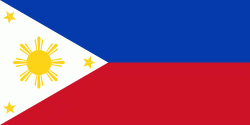
| Flag of the Philippines | |
Negritos, some of the archipelago's earliest inhabitants, were followed by successive waves of Austronesian peoples. Adoption of animism, Hinduism and Islam established island-kingdoms called Kedatuan, Rajahnates, and Sultanates. The arrival of Ferdinand Magellan, a Portuguese explorer leading a fleet for Spain, marked the beginning of Spanish colonization. In 1543, Spanish explorer Ruy López de Villalobos named the archipelago Las Islas Filipinas in honor of Philip II of Spain. Spanish settlement through Mexico, beginning in 1565, led to the Philippines becoming ruled by the Spanish Empire for more than 300 years. During this time, Catholicism became the dominant religion, and Manila became the western hub of trans-Pacific trade. In 1896, the Philippine Revolution began, which then became entwined with the 1898 Spanish–American War. Spain ceded the territory to the United States, while Filipino revolutionaries declared the First Philippine Republic. The ensuing Philippine–American War ended with the United States establishing control over the territory, which they maintained until the Japanese invasion of the islands during World War II. Following liberation, the Philippines became independent in 1946. Since then, the unitary sovereign state has often had a tumultuous experience with democracy, which included the overthrow of a decades-long dictatorship by a nonviolent revolution.
Currency / Language
| ISO | Currency | Symbol | Significant figures |
|---|---|---|---|
| PHP | Philippine peso | ₱ | 2 |
| ISO | Language |
|---|---|
| EN | English language |
| TL | Tagalog language |


